Project Calico was CubeCats' first after-dark HAB flight and sought to collect atmospheric and light pollution data during a late evening flight.
Additionally, it sought to communicate during the flight through a COTS satellite communication platform.
The mission was launched in April 2025, from Amberley, Ohio.
Although some data was collected while the HAB was visable and the custom LED-based collision ligths were observed to work, communication was lost soon afterwards.
Due to an addtional failure in independent GPS tracking, the mission hardware was lost.
Software & Payload Team Lead: Andrea Mireles
Flight Systems Team Lead: Noah Eckstein
Project Floppa was CubeCats' first HAB flight after COVID and sought to collect a cloud sample during flight, as well as capture a 360° videos during flight.
Also included were air quality sensor measuring the amount of Carbon Monoxide (CO), Nitrogen Dioxide (NO2), Ethyl Alcohol, and Volatile Organic Compounds (VOC) in the air every 60 seconds.
The mission was finally launched in November 2024 from Amberley, Ohio and ended up travelling almost 380 miles, landing near Fredericksburg, Virginia.
Software & Payload Team Lead: Noah Schumacher
Flight Systems Team Lead: Vitoria Suchi Rezende
CATiSE members designed a high-altitude balloon launched glider that would fly from altitude and return to a point that the team selected sometime in mid-2020.
In addition to the glider, Project Lykoi would have tested the effects of high-altitude exposure on plant seeds, take a sample of a cloud, test the effects of solar cells at higher altitudes, and capture images of the earth.
Cancelled by COVID-related shutdowns.
Software & Payload Team Lead: Broc Augustus
Communications Team Lead: Seth Tumlin
Flight Systems Team Lead: Sarah Hudson
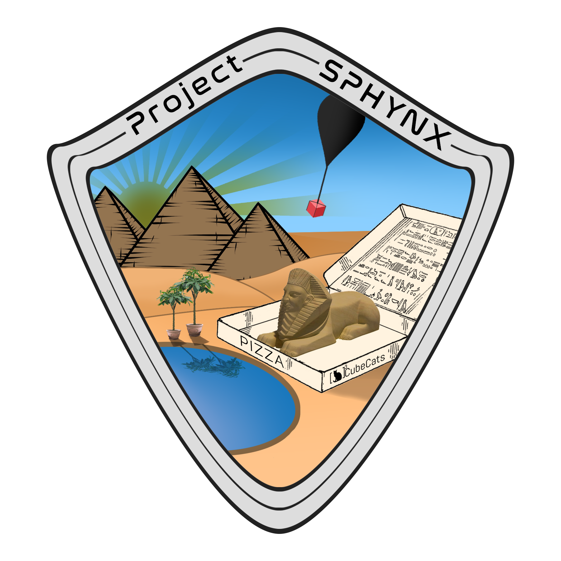
In late April 2019, a home-built solar-oven housing a pizza, a gieger counter, and sunflower seeds were launched aboard a HAB along with two GoPros and Ardu4Cam.
The objective of the mission was to check if a pizza could be cooked in the solar oven, by monitoring the temperature inside the solar oven throughout the flight and checking the radiation acting upon the pizza while the payload was airborne.
The GoPros and Ardu4Cam recorded the initial launch and the 4-hour flight.
Software & Payload Team Lead: Kartikey Pandey
Communications Team Lead: Peter Kroeger
Flight Systems Team Lead: Hunter Stephano
In late April 2018, a HAB launched with a Radio Frequency (RF) meter, a PiCam, and a 360Fly camera.
The objective of the mission was to collect data on the radio interference levels on available amateur frequencies, and to take 360-degree photographs from the edge of space.
The payload was located after the flight, but was irrecoverable due to the nature of the landing site.
Software & Payload Team Lead: Scott Lanham
Communications Team Lead: Patrick Hodgson
Flight Systems Team Lead: Ian Wells
In early April 2018, a HAB with a Raspberry Pi Zero-controlled sensor suite measured the altitude, oxygen levels, pressure, radiation, and temperature in flight to characterize the effects of high altitude on the human body.
An attached camera recorded the initial launch and part of its journey through the atmosphere with a maximum altitude of 33 km.
A GPS tracking system along with the APRS network was used to locate and retrieve the intact payload.
Software & Payload Team Lead: Aaron Boyd
Communications Team Lead: Jasmine Rosen
Flight Systems Team Lead: Dustin Meyers
In April 2017, a HAB was launched to measure atmospheric radiation and light-levels, as well as take panoramic photographs during flight.
The system was controlled using a Arduino Uno.
Using APRS, an approximate location of the payload was given, and was later retrieved.
This was the first fully successful CATiSE mission.
Software & Payload Team Lead: Evan Smith & Henry Voss
Communications Team Lead: Amanda Moores
Flight Systems Team Lead: Jacob Kennedy & Evan Burwinkle
In April 2016, A HAB controlled by a Raspberry Pi was sent into the atmosphere to take photographs using a camera.
A boom holding an OLED display extended from the payload to display names of UC CubeCats members in front of the backdrop of Earth from high altitude.
The tracking system utilized GPS and the APRS network to locate the systems's landing location.
Unfortunately, rougher-than expected weather conditions on the launch day caused the HAB to travel much further than intended, and the payload was lost somewhere in the Appalachian Mountains of Virginia or Kentucky.
Software & Payload Team Lead:Michael Gyurgyak & Tyler Parcell
Communications Team Lead: Andrew Krew & Adam Herrmann
Flight Systems Team Lead: Rob Imhoff